Stradbally - An Sráidbhaile


Notice: Undefined variable: prefix in /home/dinglepe/new.dingle-peninsula.ie/templates/yootheme/vendor/yootheme/builder/elements/layout/templates/template.php on line 3

Stradbally - An Sráidbhaile

Known as “The Gold Coast” of the Dingle Peninsula...

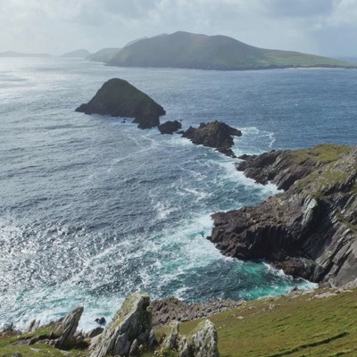
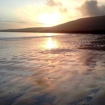
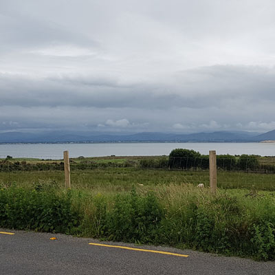
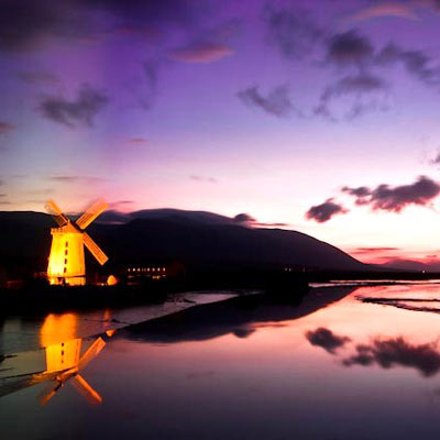
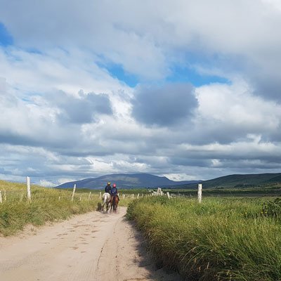
Stradbally is located on the north shore of the Dingle Peninsula halfway between Tralee and Dingle on the spectacular Conor Pass drive. This north shore of the Dingle Peninsula is also known as “The Gold Coast”. it lies on one of Ireland’s longest beaches, which stretches 12 glorious miles (20 kilometres) in length from the Maharees westwards through Castlegregory to just short of Cloghane village. The Maharees Tombola and Castlegregory village are to the north east of the village. Castlegregory village offers services for holidaymakers with a community Tourist Information Office, a supermarket, local shops, cafes and a great food scene. Traditional Irish music can be heard in the village’s pubs, particularly in the summer months.   
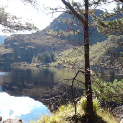
  • Glenteenassig

    Nestled in a sheltered valley of the Slieve Mish mountains close to Castlegregory is the hidden gem of Glenteenassig Forest Park. With forest streams, lakes, waterfalls and dramatic cliffs there are also great views of Brandon & Tralee Bay and the Maharees. The Coillte run park is free to visit and has a selection of walks and picnic areas with good parking.
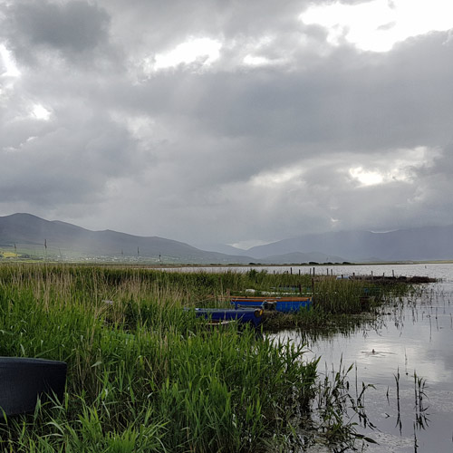
  • image of lough gill and boats

    Lough Gill

    This shallow freshwater lake is fed by the Killiney river and drains into Tralee Bay.  2.41km long and 0.8km wide the lake is populated with swans and ducks and fine brown trout which thrive in the alkaline waters. The area around the lake with sandy soil has a number of unusual plants.


  • two horses and riders on a sandy road with mountains behind at stradbally dingle peninsula ireland

    Outdoor Activities

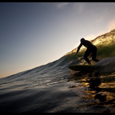
    There are many activities to enjoy in Stradbally with beautiful outdoor spaces on your doorstep and a superb 9 hole links golf course situated between the scenic Lough Gill and Brandon Bay. The north shore area is renowned for windsurfing, surfing, kitesurfing, and diving. Families can enjoy the wonderful beaches and summer camps of water based activities, festivals and events. See water activities 
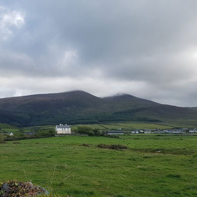
  • stradbally mountain and beenoskee dingle peninsula Ireland

    Stradbally Mountain

    Stradbally village sits at the base of Stradbally mountain and it's twin peak Beenoskee. In a hollow between the two peaks is a high corrie lake called Lough Acummenn. From here the Stradbally river tumbles downhill through the village towards the beach, passing a lovely old stone bridge and church ruin and flowing into Lough Gill.

    Stradbally mountain 798m can be climbed from the village. The recommended route is to climb the eastern shoulder of the mountain keeping the river on your right.

  • old church ruin and graveyard stradbally dingle peninsula Ireland

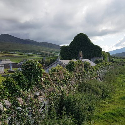
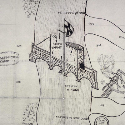
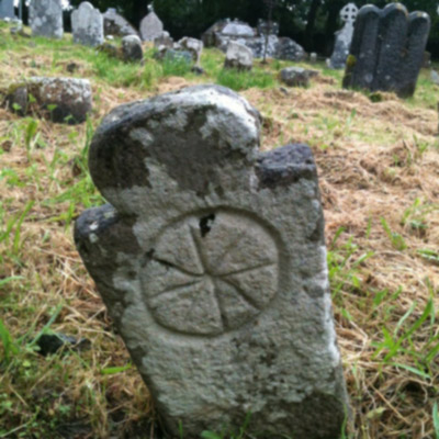
    Stradbally Old Church

    Below Stradbally village on the road down to the shore of Brandon Bay is an old graveyard. Standing on the western side of the graveyard are the remains of a late 15th /early 16th century church. Stradbally is documented as having a parish church in 1302. This church was in ruins by the 1750s and some of the stones may have come from an earlier church.

Castlegregory Brochure

Castlegregory Community have published a brochure with more information about activities, features and stories about this wonderful part of the Dingle Peninsula. The booklet /brochure is available from the Community office - click here to see the brochure in PDF format.

Read more

How to get to Stradbally

Directions:

From Tralee - 25kms 27 mins drive: Take the N86 west. At Camp Junction continue straight on the R560 Conor pass road to Stradbally.

Castlegregory

52.2585,-10.0166

Stradbally & Castlegregory - Directory

Directory links to related businesses, events and providers on the Dingle Peninsula

Read more: Stradbally - An Sráidbhaile

Aughacasla - Ath an Chaisle


Notice: Undefined variable: prefix in /home/dinglepe/new.dingle-peninsula.ie/templates/yootheme/vendor/yootheme/builder/elements/layout/templates/template.php on line 3

Aughacasla - Ath an Chaisle

How often in my dreams, to Killiney I go, and visit Castlegregory, and famous Coolroe, Or listen to the thrushes and linnets, so gay, all in green, green Aughacasla

The small village of Aughacashla, on the Conor Pass road, lies on higher ground with magnificent views over Tralee Bay and across to the shoreline of North Kerry. Surrounded by farmland with some beautiful traditional farmhouses, outhouses and farmyards, the area is laced with miles of small verdant country roads ideal to explore on foot or by bicycle.

The Dingle Peninsula is full of contrasts. In Aughacasla you will find on one side of the road the remote hidden valley of Glenteenassig with forest, lake and bog and on the other mile upon mile of golden sandy beaches, sand dunes and camp sites reached by narrow peaceful lanes. In between lies a patchwork of green fields tended by a thriving farm community with a strong local tradition.

  • Glenteenassig lake Aughacasla Dingle Peninsula Kerry Ireland

    Glenteenassig Forest

    Glenteenassig forest recreation area is one of the hidden wonders of the Dingle Peninsula. Glannteenassig means ‘Valley of the Waterfalls’. This sheltered valley sits in the foothills of the Slieve Mish mountains.behind the village of Aughacasla. With 1100 acres of woodland, mountain, lake and bog, there are wonderful walks, waterfalls and lakeside picnic sites.

  • lake

    Aughacasla Old National School

    The much loved old school building in the centre of Aughacasla village dates back to 1896. Locals staged an all night vigil here in 2000 to protect the disused building from demolition and save it for posterity. Village children now attend a new school nearby. Handwritten stories, poems and songs from the locality were collected from the school children here in 1938 and form part of the 'the School's Collection' archive at Dúchas.ie.

  • views of seven hogs

    Tralee Bay & Seven Hogs

    Set on high ground the village of Aughacashla looks out over Tralee Bay with great views of the The Maharee Islands. The seven islands are known locally as 'The Seven Hogs' and a bar in the village by this name has become a local landmark.

How to get to Aughacasla

Directions: Aughacasla village is located on the north coast of the Dingle Peninsula, Co Kerry on the R560 approximately 5km to the west of Camp and 4km to the south east of Castlegregory. Tralee is 20km away,

From Tralee take the N86 west and at Camp Junction take the R560 andfollow the signs for the Conor Pass. 
From Dingle take the Conor Pass road. Aughacasla is the next village after Stradbally.

annascaul

52.1511,-10.0555

Aughacasla - Directory

Directory links to related businesses, events and providers on the Dingle Peninsula

Select another village / townland

  • ANNASCAUL - ABHAINN AN SCÁIL
  • CAMP - AN COM
  • VILLAGE
    Ballydavid - Baile na nGall
  • VILLAGE
    Ballyferriter - Baile an Fheirtéaraigh
  • VILLAGE
    Cloghane & Brandon - An Clochán & Bhreannáin
  • VILLAGE
    Castlegregory - Caisleán Ghriarie
  • Dingle - Daingean Uí Chuis
  • CAMP
    Dunquin - Dún Chaoin
  • VILLAGE
    Lispole & Minard - Lios Póil & An Mhin Ard
  • The Blasket Islands - Na Blascaodaí
  • VILLAGE
    The Maharees - Na Machairí
  • VILLAGE
    Ventry - Ceann Trá

Read more: Aughacasla - Ath an Chaisle

Castlemaine - Caisleán na Mainge


Notice: Undefined variable: prefix in /home/dinglepe/new.dingle-peninsula.ie/templates/yootheme/vendor/yootheme/builder/elements/layout/templates/template.php on line 3

Castlemaine -  Caisleán na Mainge

In my boyhood days when I knew no care how joyfully I played, In its field so green and beautiful it grows a silvery plain.

But alas, alas those days are gone, I no longer can remain, But I must go full of grief and woe from you sunny Castlemaine.

The village of Castlemaine is the south east gateway to the Dingle Peninsula and sits on the banks of the river Maine at the base of the Slieve Mish mountains at the eastern end of Dingle Bay. From this small picturesque village the river Maine twists and turns as it flows west to join the Atlantic ocean at Castlemaine Harbour. 

Throughout history the river Maine was a strategic crossing point between north and south Kerry and the village takes its name from a defensive castle erected on a bridge over the River Maine in medieval times. Nowadays the N70 road from South Kerry to the county capital of Tralee crosses the river Maine and passes through the centre of the village. A junction with the R561 marks the start of the south coast of the Dingle Peninsula.

The whole area of Castlemaine and the estuary at Castlemaine harbour is known for diverse wildlife and flora as well as geological beauty with views of mountains, sea and farmland. Close to Kerry Airport and to the Ring of Kerry the friendly village of Castlemaine makes an ideal base for exploring Kerry and a great first stop when visiting the Dingle Peninsula.

  • image of sheet music for wild colonial boy ballad

    'The Wild Colonial Boy' ballad

    Castlemaine is known for being the birthplace of the Wild Colonial Boy whose exploits in Australia were made famous in the well known ballad. There are many different versions of the Irish/Australian ballad 'The Wild Colonial Boy'. The song tells of a young Irish emigrant convicted of highway robbery and sentenced to death. After escape this Robin Hood type character robbed from the rich to feed the poor until he was captured and shot. The Irish version of the song is about ‘Jack Duggan’ who left Castlemaine in the early 1800s. A bar in the village is named after him.

    “There was a wild colonial boy, Jack Duggan was his name, He was born and raised in Ireland in a place called Castlemaine."


  • view of castlemaine harbour area from the R561 road dingle peninsula Co.kerry Ireland

    Castlemaine Harbour SAC

    The area around Castlemaine is of major ecological importance, with coastal habitats of excellent quality. Castlemaine Harbour is a very important site for wintering waterfowl providing good quality feeding and roosting habitats for an excellent diversity of waterbirds, including geese, waders, divers and seaduck. Species of birds found here include Brent geese, cormorants, shelduck, wigeon, dunlin, redshank, golden plover, oystercatcher. Part of this area is a Statutory Nature Reserve. it includes long stretches of river and stream which are excellent habitats for Salmon, Lamprey and Otter. 

    The protected natterjack toad is one of the rare animals found in the area.

  • The Siege of Castlemaine

     Castlemaine takes its name from a defensive castle built on a bridge spanning the River Maine.The River Maine would have flooded in winter and was a strategic river crossing in Munster. A pen and ink map drawing depicting the Castle on the bridge at Castlemaine exists in the UK National Archives, Kew, England. The drawing is of the Siege of Castlemaine by Sir John Perot, Lord President of Munster, in 1572 and was probably drawn shortly after Sir John Perrot's victory in August 1572. The map shows the castle spanning the River Maine, Perot's camp, two Gallyglas camps, Macarte More's camp, two cannons firing at the castle, the first camp, the abbey, the ferry, wood and bog. The siege was part of a campaign by Perot against rebels.


How to get to Castlemaine

Directions: From Kerry Airport take the R561 west. From Tralee take the N70 south. Castlemaine is where the N70 intersects the R561. 


Castlemaine

52.1685,-9.7012

Castlemaine - Directory

Directory links to related businesses, events and providers on the Dingle Peninsula

  • See & Do

    What to see & do in Castlemaine

  • Eat & Drink

    Where to eat in Castlemaine

  • Stay

    Where to stay in Castlemaine

  • Shop

    Where to shop in Castlemaine

    No items found.

Read more: Castlemaine - Caisleán na Mainge

Blennerville - Cathair Uí Mhoráin


Notice: Undefined variable: prefix in /home/dinglepe/new.dingle-peninsula.ie/templates/yootheme/vendor/yootheme/builder/elements/layout/templates/template.php on line 3

Blennerville - Cathair Uí Mhoráin

Gateway to the Dingle Peninsula

The first sighting of the Dingle Peninsula from the N86 is an unforgettable vista. Driving from Tralee the low lying road between a canal and river forms a causeway running towards this iconic view. A seven bay stone bridge spans the River Lee at its estuary, the Slieve Mish mountains rise up from the water stretching westwards along the Dingle Peninsulas north shore and the horizon opens wide with promise. Before this dramatic backdrop of ocean, sky and mountain, on the south bank of the River Lee stands the crisp white outline of a windmill surrounded by a cluster of buildings. Welcome to the scenic and historic village of Blennerville, gateway to the Dingle Peninsula.

Blennerville was once the main trading port for nearby Tralee and the village has fine examples of late eighteenth and early nineteenth century architecture. Following the opening of the Canal to Tralee in 1846 trade at Blennerville port went into serious decline. The remains of Blennerville quay which can still be seen west of Blennerville bridge became the embarkation point for thousands of people who left the country during and after the famine.

Nowadays Blennerville welcomes visitors from all over the world as they travel on to the Dingle Peninsula. Blennerville Visitor Centre introduces the visitor to a working windmill, an exhibition gallery, craft shop and restaurant. The famous walking trail, the Dingle Way begins in Blennerville and runs along the coast before crossing the central spine of mountains, dropping downhill and meandering west towards the port of Dingle.

  • image of Tralee Dingle Railway track going towards Blennerville - photo by Nigel Cox

    Tralee Dingle Railway

    Blennerville Train Station

    In 1891 the Tralee and Dingle Light Railway opened connecting Tralee with Dingle along one of Europe's most western railway lines. A station operated at Blennerville until the line closed in 1953. Blennerville Station was located just south of the bridge. The single track railway line was often flooded by high tidal water and trains could be delayed for hours waiting for the water to subside.

    in 1993 a short 3-kilometre restored section of the line was opened but this section of railway is no longer in operation. A model railway and exhibition display can be found in Blennerville Windmill visitor centre.

  • Blennerville Windmill

    Landmark and historic building

    The famous landmark of Blennerville Windmill was built in 1800 by order of Sir Rowland Blenerhassett. The 21 m high stone built mill has five floors and sails that measure approx 18 m. It was used for milling grain, for use by local people and for export to Great Britain. 

    A major project during the 1980's restored Blennerville Windmill to full working order and it was opened to the public in 1990. The visitor centre next to the windmill offers guided tours of the mill and includes a craft centre, model railway, art gallery, audio-visual presentation and restaurant.

  • The Jeanie Johnston

    Famous Famine Ship Blennerville

    Built in Quebec Canada in 1847 the famine ship Jeanie Johnston sailed on 24th April 1848 from Blennerville, Co. Kerry to Quebec with 193 passengers on board. Over the next seven years the ship made 16 voyages to North America carrying over 2,500 emigrants safely to the New World. She sailed to Baltimore, New York and Quebec and on those voyages never lost a passenger to disease or the sea.This was in stark contrast to the “coffin ship” reputation of other vessels who lost many passengers to hunger and disease.

    A replica of The Jeanie Johnston was constructed in Blennerville and sailed to Canada and the United States in 2003. It can be seen berthed on Custom House Quay in Dublin.


">

How to get to Blennerville

Directions: From Tralee take the N86 towards Dingle. 

Blennerville

52.2556,-9.7379

Blennerville - Directory

Directory links to related businesses, events and providers on the Dingle Peninsula
  • See & Do

    No items found.

  • Eat & Drink

    No items found.

  • Stay

    No items found.

  • Shop

    No items found.

Read more: Blennerville - Cathair Uí Mhoráin

Boolteens / Keel - Na Buailtíní

Boolteens-Keel

"wonderful area from Castlemaine to Inch”.

Spread out along the foothills of the Slieve Mish Mountains the twin villages of Boolteens and Keel welcome visitors to the Dingle Peninsula with a colourful display of flowers and rural old world charm. A small rural settlement with a strong community, Boolteens and Keel are linked with shared services which cater for the needs of the surrounding area. The school, childcare centre, church and GAA pitch are all located in residential Keel, while the traditional village centre is at the crossroads in Boolteens with a few small businesses and pubs serving food.

This quiet area is a great place to base yourself on the Dingle Peninsula, only twenty mins drive from Kerry Airport and within easy reach of spectacular Inch Beach.
Walkers and explorers will love Caherconree and the mountain road called 'Bóthar na gCloch' (road of the stones). For fishing Keel pier is known for bass, flounder and plaice.
Historic places to check out are old Keel church and graveyard, and the village crossroads with some lovely reminders of times gone by, the pump, the blacksmiths forge and even an old-fashioned petrol pump.

  • Uphill Downhill walk

    A great way to enjoy the views, countryside and wildlife of the Boolteens Keel area is to explore the popular Uphill Downhill 13km looped walk. Starting and ending at the carpark opposite Boolteens Church this well sign posted trail brings you up close to nature, with fields, a riverbank pathway, quiet roads and a short stretch on the R561. It takes approx. 3hrs and 30 mins to complete.

  • keel burial ground

    The old Keel cemetery is to be found on the southwest side of the Castlemaine to Annascaul road, two miles southwest from the village of Boolteens. It contains the ruins of an old church.

  • Historical heritage

    The village of Boolteens/ Keel has a rich historical heritage evidenced by a range of structures such as the old village pump and the remains of the McCarthy Mor Castle. An additional point of cultural interest is the old blacksmith forge within the village.

How to get to Boolteens Keel - Na Buailtíní

Directions: Boolteens is on the R561 4 kms west of Castlemaine Co Kerry. From Tralee take the N70 to Castlemaine and turn right onto the R561 .
From Farranfore Airport: Boolteens is a 20 min drive on the R561. 

Boolteens

52.1773,-9.7528

Boolteens keel - Directory

Directory links to related businesses, events and providers on the Dingle Peninsula

  • See & Do

    What to see and do in Boolteens & Keel

    No items found.

  • Eat & Drink

    Where to Eat and Drink in Boolteens & Keel

    No items found.

  • Stay

    Where to stay in Boolteens & Keel

    No items found.

  • Shop

    Shops in Boolteens & Keel

    No items found.

  • Festivals

    Festivals & Events in Boolteens & Keel

Read more: Boolteens / Keel - Na Buailtíní